Green Swamp West (GSW) is an area adjacent to the Richloam tract of the Withlacoochee State Forest.
I hadn't been there in a while, and it's only half the distance from home to GSW as it is to Hidden Pond. It was also a week before the start of Archery Hunting season. I figured if I didn't go that week, I'd have to wait till Spring. (Barepacking and naturist camping aren't the wisest pastimes during hunting season in hunting areas.)
I left late Thursday morning. The weather forecast called for 60% chance of afternoon showers, so I wanted to be in camp with tent up before the storms.
I knew of a campsite that was only about two miles from the parking area (my estimate). I figured I could get there before the storms, then after the storms were over with, use this camp as a base camp to do exploratory hikes. (Besides the Florida Trail segment, there are horse/bike trails, as well as jeep trails.)
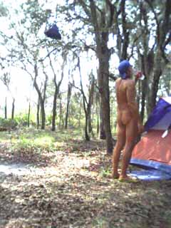
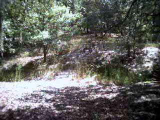
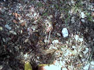
| I got the tent up about 15 minutes before the rain hit. I had time to get this picture and take a long-awaited drink of water before I had to put the camera away. | |
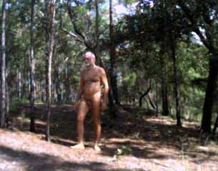
Other than being rushed due to weather, the hike in was nice. Since I could clearly hear the cars approaching on Highway 471, it was easy to tell when I had time to get out of my shorts and put on my "apron". I have a weighted dish-towel I tuck under the pack's hip strap in the front. My pack frame and sleeping bag extend well below my buttocks, so I am already covered back there. To a passerby it would look like I was hiking in an Indian breech cloth, but it is more comfortable. The weights are sewn into the bottom seam of the dish-towel to keep the wind from blowing it up.
I wear this when I start my hikes at trailheads where someone might drive up as I'm hiking to or from my vehicle (which is pretty much all trailheads). Once out of sight of the road/trailhead, I tuck the towel away between my pack frame and my back. That way if I hear something like a Scout Troop coming up the trail, I can reach it and be covered in seconds. This is usually the only item that could be construed as clothing that I take backpacking in Summer weather (unless you count socks and boots).
My hiking was on Thursday - Saturday. I didn't expect to see anyone on Thursday. Friday I figured someone might hike by in the evening. Saturday I figured maybe early to mid morning. I was pleasantly surprised to see no one until late Saturday after I got back to the trailhead.
The trail register did show some occasional usage by geo-cachers, but few hikers (remember most textile hikers prefer cooler weather for hiking).
It would seem that GSW is ideal for naturist hiking and camping as long as you go during Summer/early Fall (or late Spring after Turkey Hunting season is over)
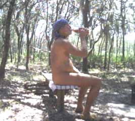 | The weather was hot and I drank plenty of fluids. Here I'm tossing back a "lukewarm one". Crystal Lite peach tea. |
The hiking trail parallels a jeep trail for much of those first two miles, and even merges with it for short stretches. Obviously, you need to be alert if you are hiking as nature intended.
The hiking trail does leave the jeep trail behind, and the first established campsite is only reachable by foot.
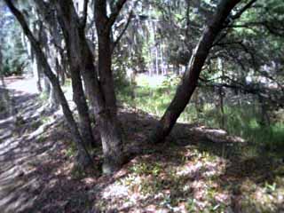
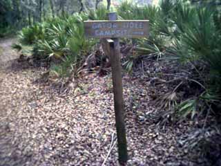 | The established campsite is hard to miss. |
| Looking at the campsite from the sign on the trail. Notice the table and bench. | 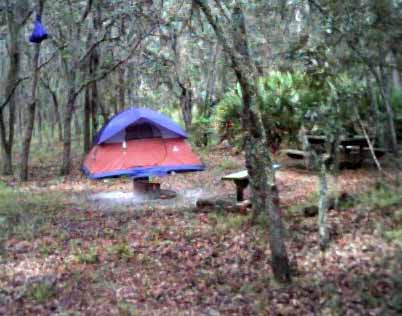 |
As you can see, the main campsite is not far from the trail. During warm weather weekdays, this is probably not an issue. Weekends might be different (two hikers went in Saturday after I had come off the trail). To the East of this sign is the actual Gator Hole (apparently an old quarry - now a pond with a large island). During low and normal water levels, there's a "bridge" to the island. The island is large enough to make camp without being very visible from the hiking trail. More on the island later.
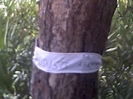
In case anyone did hike by, I posted one of these signs a hundred yards or so each direction down the trail from the campsite so no one would be caught off-guard by my natural state.
I did my first side hike on Thursday afternoon after the sky went from overcast to clear blue. I only planned a short hike, so I only took a water bottle, my walking staff, and my moccasins. (I didn't feel like stapping the hiking boots back on).
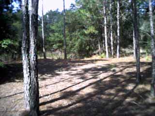
The next morning, Friday, I made my biggest hike. (This time I wore the hiking boots.) I started Westward on the hiking trail. The trail crosses a jeep trail a couple of times before running parallel to it in a big open area. From the looks of it, much of GSW used to be a large ranch or ranches.
When I got to the point where the trail paralleled the jeep trail to the North, I took a lesser-traveled jeep trail to the South. Since GSW is bounded on the South and West by the Withlacoochee River, and Highway 471 to the East, I knew I couldn't get too far lost by going South and East.
It was a long hike, but I saw some fantastic scenery and got back to camp by lunchtime. There are a lot of fantastic campsites except for one small detail. No water within a reasonable distance. I was there during low water, so it's possible some of the low areas I passed would have open water when the water levels are normal or high (it is the Green Swamp after all.)
Back in camp I did the lunch thing. It's a novelty for me to have a picnic table while naturist camping.
After lunch, I explored the island in the Gator Hole. This island is long and narrow, and if I had to guess, I would say it's at least 10-20 acres. Below is what you first encounter when you cross the "bridge"
This island is extraordinarily flat. I am positive it got that way artificially. It must have been part of the old quarry operation. I walked the perimeter of the island looking for campsites. Note in the shot below how unnaturally straight the edge of the island was.

I had already seen that the island was flat and covered in pine needles, so I opted to wear the moccasins rather than the boots.
 | I did find several good campsites on this island and noted the lack of evidence that anyone ever used it (such as no campfire remains,etc.). Then I saw this beer can. |
The can was so old that all the paint had faded to shades of white. Apparently the island isn't used much.
| This was taken from the South end of the island looking West across the Gator Hole at the hiking trail (the white sand) | 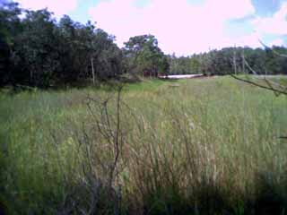 |
I hiked again on Saturday morning before the day could get hot. It wasn't as long of a hike as Friday, but I was glad I wore the boots instead of moccasins.
When I wasn't hiking, I was reading in my hammock, fixing meals, and fetching water from the Gator Hole. Getting water was tricky since the bank was so steep.
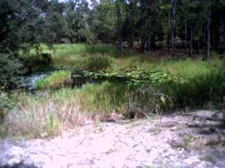
There's a couple of reasons I figured the Gator Hole is an old quarry. First, if you look at the steep banks below, you'll see how artificial they look in what is otherwise a Florida Pine Flatwoods area.
 | Secondly, I found this old rusted steel cable which I suspect was used for dredging, judging from the fact it's largely buried in the steep bank. |
Thirdly, maybe 1/4 mile to the West down the hiking trail from the Gator Hole is an unmistakable quarry with walls 20-30 feet deep or more. The deeper quarry shows mining was carried out at GSW in the past.
Bottom line, GSW is not as much of a barepacking/naturist camping paradise as Juniper Prairie Wilderness area, but if you can go in the Summer, it's worth the trip.
The downside is that you can forget about any swimming (about the best you can do there is douse yourself with a pot of water once in a while), and parking is not at all secure. I would recommend you have someone drop you off at the trailhead and pick you up when you come out. Cell coverage is spotty, so I wouldn't count on it. If you do have to leave your vehicle at the trailhead, don't leave anything valuable in it. If you have fancy tires, or anything like that, they may not be there when you come out.
The Eastern trailhead for GSW is located off Highway 471 in Sumter County on the West side of the road immediately North of the Withlacoochee River bridge.
This trail does connect with the loop trail in Richloam. I have not gone that far yet. Maybe next Spring I can make that trip.